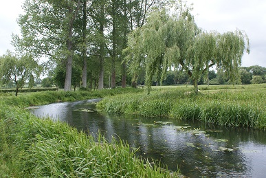
The River Wensum has its source between the villages of Colkirk and Whissonsett, flows through Fakenham and the Pensthorpe nature reserve, and on through Swanton Morley, Taverham and Norwich, flowing out of the city at Trowse to its confluence with the River Yare at Whitlingham.
In 1993, 71 km of the Wensum was designated a Site of Special Scientific Interest and Special Area of Conservation and the river is recognised as one of the most important chalk river habitats in the country with over 100 plant species and a rich invertebrate fauna. In 2001, the River Wensum was designated a Special Area of Conservation (SAC) under the EU Habitats Directive. Species requiring conservation objectives are: Bullhead (fish), Brook Lamprey (fish), Whiteclawed crayfish, Desmoulin’s Whorl Snail and additionally watercourses with water crowfoot and water starwort vegetation (Ranunculus habitat).

The River Wensum flows through some of the most environmentally sensitive areas in the United Kingdom.
The Wensum catchment drains an area of Norfolk in East Anglia about 40 km west-east and 25 km north-south with relatively low-lying topography ranging from about 80 m in the west to a few metres above sea level where it joins the River Yare. The whole of the Wensum catchment is underlain by the Cretaceous Chalk. In the eastern part of the catchment, the Chalk is overlain by Pleistocene Crag sands and gravels. Both these bedrock strata are overlain by a complex sequence of Pleistocene glacial tills and glaciofluvial sands and gravels and Holocene deposits (blown sand, alluvium, peat and river terrace deposits).
Of the 90.6 ha of ‘River and Stream’ habitat included in the SSSI, 99.4% is considered to be ‘unfavourable and declining’ mostly due to sediments, bank poaching and diffuse water pollution. The main river channel currently has ‘poor’ ecological status (and is also predicted to be ‘poor’ status in 2015). 40% of the water bodies in the catchment are at risk of reaching 50 mg/l NO3 (i.e. failing drinking water quality standards for nitrate). (Nitrate in rivers largely comes from runoff from agricultural fertilisers). 27% of the water bodies in the catchment are at risk of failing phosphorus (P) standards. (Phosphorus in rivers can come from runoff from agricultural fertilisers and from household effluent from sewage treatment works and septic tanks).

)