

|
|
|||
|
|
|||
|
|
|||
|
|
|||
|
|
|||
|
|
|||
|
|
|||
|
|
|||
 |
|||
Saturday 3rd - Greenland Lee Cyclone |
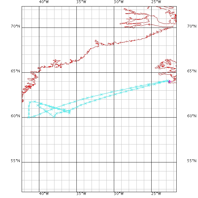
After several days of planning the chief scientists finally ended up with a flight plan that we all believed could capture the Greenland Lee Cyclone centre. After the morning brief Saturday morning at 0700 seven scientist set course for the airport. The discussion about the cyclone location was still going on since the latest model runs and satellite pictures on hand during the night gave us more information about the possible location of the low system. Finally, we were air borne and all instruments were turn on. As we started at our first leg drop sondes were dropped and data was streaming into the flight science computers. Discussions about wind speed, direction, moisture, drop sondes data, cloud features, and more went continuous at the flight intercom. Chief scientists had to make several decisions depended on the data received during the flight. As time went the data indicated that we were on the right track, but given the small size of the low centre we could easy pas it only 100 km without knowing it.
|
||||
Suddenly the wind speed started to fall rapidly. Directions were also changing. What is going on? Are we getting close to the eye? Many questions went over the intercom. Strong Greenland Lee Cyclones my get an “eye” at the centre of the systems, if the low reach hurricane wind force. The eye area are describes as the centre of such lows systems were wind speeds are calm (3-6 m/s), and no or little clouds are found. The sea can easy been seen from satellite. The eye area is surrounded by a wall of cloud with strong winds (25-35 m/s). Few minutes later we got the answer. Yes, it was the eye. A clear wall of clouds in a cylindrical form was surrounding the low centre. Inside calm sea was observed and almost no clouds. All scientist was thrilled about the success of the mission. As we moved out of the eye and through the wall we experienced as expected strong winds, precipitation and change of wind direction. Wind speed up to 35 m/s was measured. At a small open location inside the clouds we could see that ocean was blown flat by the strong wind. This is caused that the wind is so strong that large waves can’t be built up since the wind tears the larger waves apart. The flight continued several legs crossing the low from different angles. Drop sondes data showed meteorological data from plane height down to the surface. No failures on sondes gave 15 sondes drops with valuable data of lower levels. As we came back to the office we were met by smiling scientist and congratulations. Ian, the chiefs scientist congratulated us and showed us what we just had went true. A satellite picture of a most beautiful Greenland Lee Cyclone. |
||||

