

|
|
|||
|
|
|||
|
|
|||
|
|
|||
|
|
|||
|
|
|||
|
|
|||
|
|
|||
 |
|||
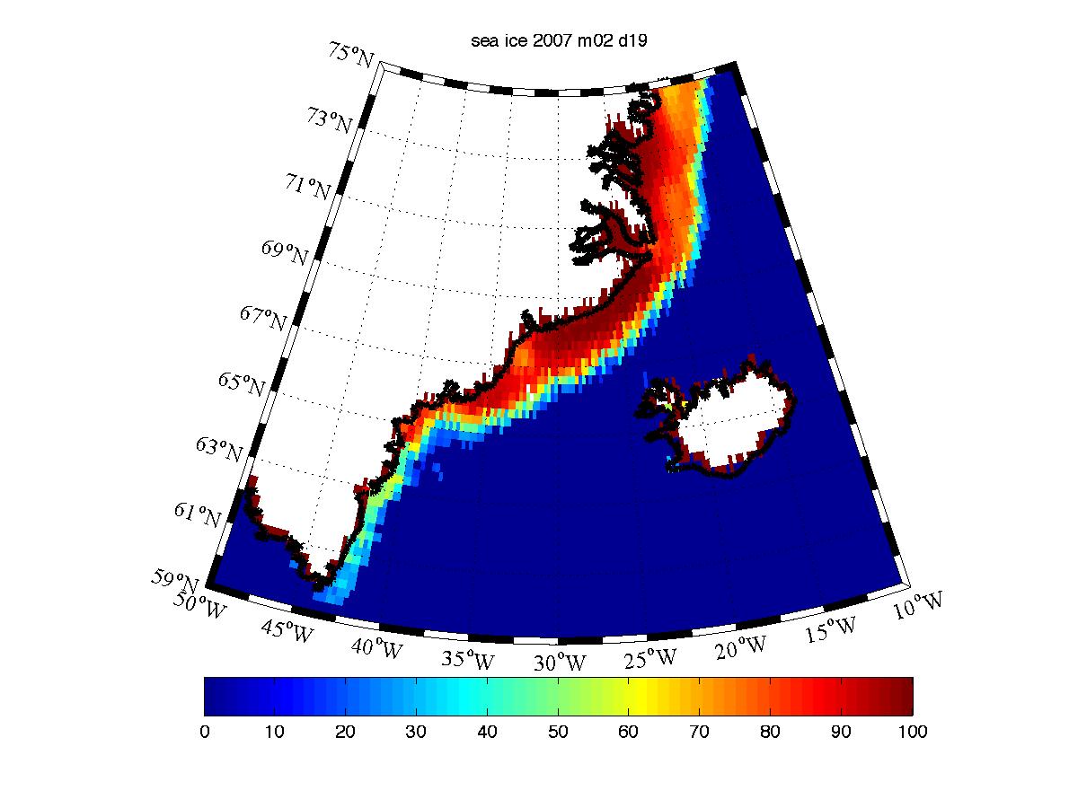
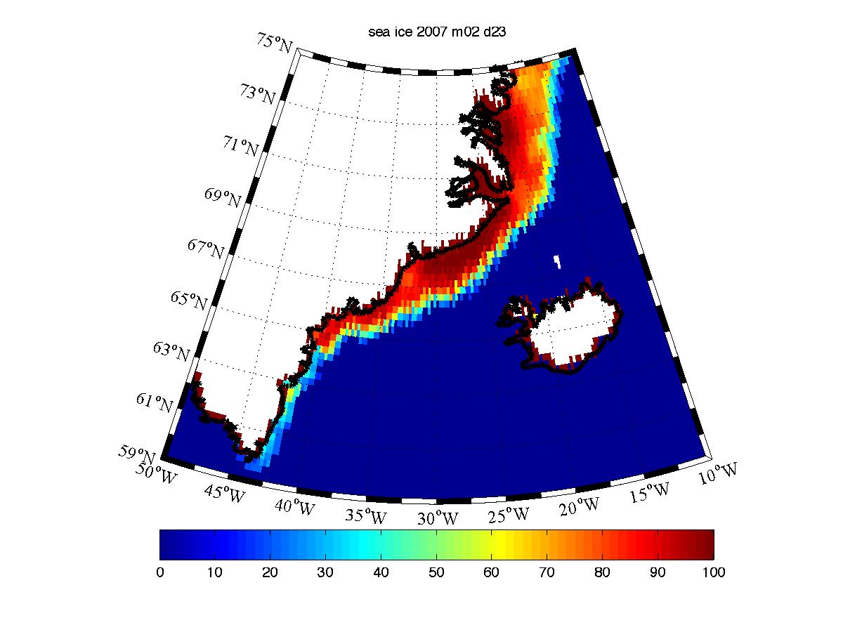
Sea Ice Data
This data is from the NSIDC NEAR REAL-TIME DMSP SSM/I DAILY POLAR GRIDDED SEA ICE CONCENTRATIONS dataset
Data has been interpolated to a lat/lon .25deg by .25deg grid extending from 55N to 80N and 50W to 0W
For each day of the field program, there is:
1)a matlab file sea_ice_2007_mxx_dyy.mat that contains the sea ice concentration field and that lats and longs of the data
2)an ascii file sea_ice_2007_mxx_dyy.dat that contains a 101*201 matrix of sea ice concentrations (bad/land datapoints=-999)
3) an image file sea_ice_2007_mxx_dyy.jpg
There are 2 additional text files lat.dat & lon.dat that contain the lats and longs of the data
For additional info, please contact Kent Moore gwk.moore@utoronto.ca
Please note that there are occasional bad data points over the open water/sea ice. They are usually the result of precipitation.
For complete documentation and more information on the underlying dataset, please see:
http://nsidc.org/data/nsidc-0081.html
| Date | Matlab File | ASCII File | Image |
| 19/02/07 | .mat | .dat | .jpg |
| 20/02/07 | .mat | .dat | .jpg |
| 21/02/07 | .mat | .dat | .jpg |
| 22/02/07 | .mat | .dat | .jpg |
| 23/0207 | .mat | .dat | .jpg |
| 24/02/07 | .mat | .dat | .jpg |
| 25/02/07 | .mat | .dat | .jpg |
| 26/02/07 | .mat | .dat | .jpg |
| 27/02/07 | .mat | .dat | .jpg |
| 28/02/07 | .mat | .dat | .jpg |
| 01/03/07 | .mat | .dat | .jpg |
| 02/03/07 | .mat | .dat | .jpg |
| 03/03/07 | .mat | .dat | .jpg |
| 04/03/07 | .mat | .dat | .jpg |
| 05/03/07 | .mat | .dat | .jpg |
| 06/03/07 | .mat | .dat | .jpg |
| 07/03/07 | .mat | .dat | .jpg |
| 08/03/07 | .mat | .dat | .jpg |
| 09/03/07 | .mat | .dat | .jpg |
| 10/03/07 | .mat | .dat | .jpg |
| 11/03/07 | .mat | .dat | .jpg |