
 |
||||||
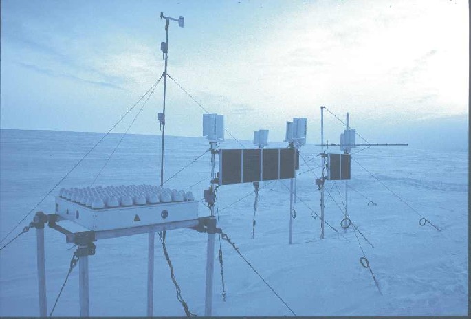
Deployment of an autonomous Doppler sodar wind profiling system in Coats Land, Antarctica during 2002 and 2003
The design, development and deployment of the system is documented in:
-
Anderson, P. S., R. S. Ladkin and I. A. Renfrew, 2005: An autonomous Doppler sodar wind profiling system, J. Oceanic Atmos. Tech., 22, 1309-1325.
-
Link to publications here.
- BAS Fieldwork report - 2000, and figures.
- BAS Fieldwork report - 2002.
Deployment in 2002:
The system was installed in 2002 by Russ Ladkin and Ian Renfrew.
Redeployment in 2003
Russ Ladkin and Phil Anderson visited in 2003 to repair and redeploy. Some damage was sustained to the power system during 2002, in particular the wind generators. Despite this, the system worked well until running out of power during the austral winter. However on the return of solar recharging further soundings were made during spring 2002. During 2003, on redeployment without the wind generators, power was saved till the winter months when a number of excellent observation periods were obtained.
Quicklook pictures of all major observing periods are available here.


