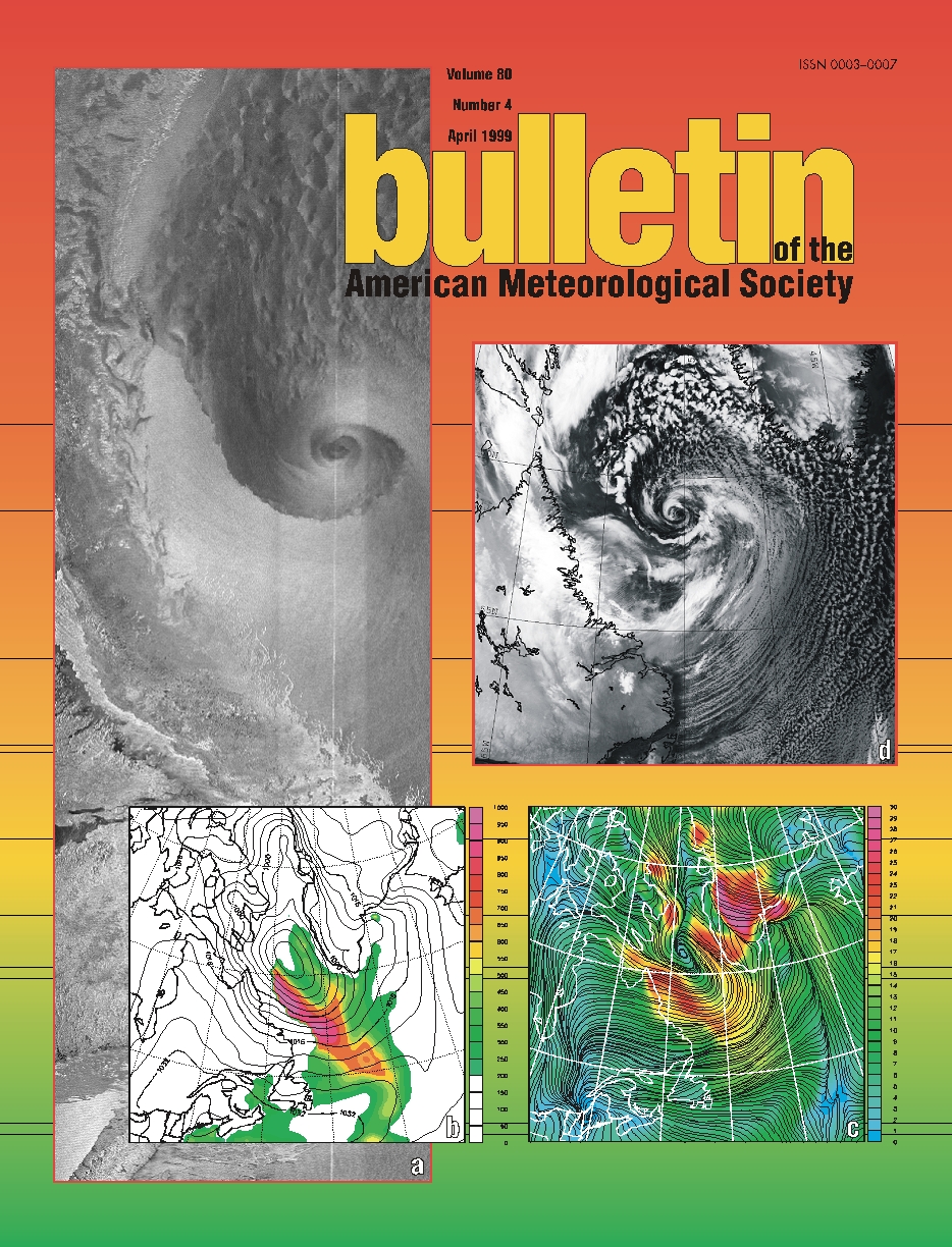
Four representations of a low pressure system that filled the
Labrador Sea basin on 30 January 1997. The cyclonic circulation
associated with the system led to an outflow of cold and dry
continental air over the relatively warm surface waters of the
Labrador Sea, as a result of which intense air-sea interaction
occurred. Panel (a) shows an AVHRR infra-red satellite image of the
Labrador Sea region from NOAA-12 at 2103 UTC 30 January 1997. The
cellular convection to the north and east of the vortex center and the
cloud streets to the south are evidence of the intense air-sea
interaction that was taking place.
In support of the Labrador Sea Deep Convection Experiment, the
Naval Research Laboratory and the University of Toronto collaborated
to provide real-time forecasting for use in the planning of the
meteorological and oceanographic field work. Panels (b) and (c) are
from a forecast of the Labrador Sea region valid at 21 UTC 30 January
1997. Panel (b) shows sea-level pressure (contours every 4 mb) along
with surface total (sensible plus latent) heat flux (color bar in W
m-2). Panel (c) shows 10 meter streamlines and wind speed (color bar
in m s-1).
A novel representation of the cyclonic system is presented in
panel (d), a Radarsat Synthetic Aperture Radar image of the Labrador
Sea at 2130 UTC 30 January 1997. The high resolution of the image (250
m) allows for a detailed visulization of the impact that the storm
system has on the surface of the Labrador Sea. The lighter shading
corresponds to a high surface reflectivity, hence over open water this
indicates a rough sea surface due to high wind speeds. Note the
reflectivity is also affected by wind direction. A vortex associated
with the low pressure system is clearly seen in the image. The sharp
discontinuity in reflectivity and hence in wind speed and direction to
the south of the vortex matches well with the COAMPS forecast winds in
(c). The mottled pattern to the north is the surface representation of
the cellular convection seen in (a). The high resolution of the image
(250 m) also allows a close examination of the sea ice that hugs the
Labrador coast. Darker landfast sea ice can be seen along the Labrador
coast south of the vortex, while the bright marbled regions farther
offshore are regions of new ice production. The radarsat image is
copyright the Canadian Space Agency 1997.