This apparent "slighting" leads him to suggest that
"part, at least, of this relict landscape is of prehistoric, and presumably Iron Age, date."
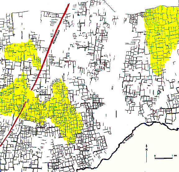
The illustration below reproduces the eastern part of the map appearing in his "The Origins of Norfolk" (Manchester University Press, 1993). Colour has been added to highlight the oblique Roman road (in red) and the areas of field boundaries (in yellow) which, in my opinion, may derive from Roman planning (see below).
This may not be chance. The figure below, which covers the westernmost highlighted areas, shows how existing roads and tracks fit the limites (red solid lines). Furthermore, a Fourier analysis shows that the most common frequency of subdivision of the squares (dotted boundaries) is by three, a plausible result, documented in the writings of the Roman land surveyors.
Hence it seems likely that a large part of this landscape is derived from a centuriation, and that the obliqueness of the Roman road does not necessarily imply that it is later than the fields. In fact, since there are no oblique relationships between main road and centuriation in this area, it is quite possible that the earlier (more southern) part of the road was surveyed before the land survey was started.
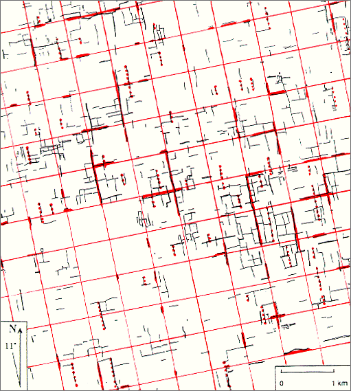
Drawn from late C19 Ordnance survey maps.
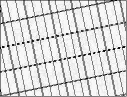 The animation on the left shows how part of this landscape near Dickleburgh may have changed from the possible original Roman pattern to what could recently be picked out in the landscape. Double lines represent the limites and single lines represent the major divisions at 800 feet which are indicated by the Fourier analysis.