 Oblique relationships (evidence for planning).
 Reconstructed views of Venta Icenorum.
 Theories of the origin of this Ancient Landscape.
The centuriation appears to have been modified by later local parcelling, for details see an article in the apparently defunct web journal "Evolutions".
Oblique relationships (evidence for planning).
Reconstructed views of Venta Icenorum.
Theories of the origin of this Ancient Landscape.
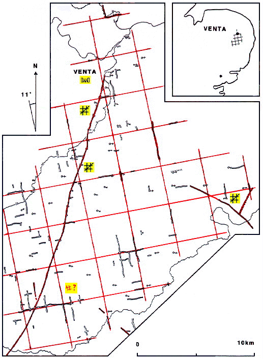
Based on the 1974 and 1981 Ordnance Survey 1:50,000 maps with the permission of the Controller of her Majesty's Stationery Office "C" Crown Copyright.