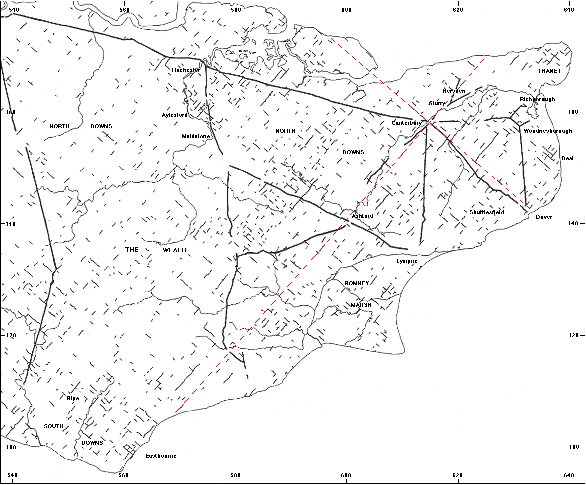
This map shows the possible extent of the system. Traces are those corresponding to limites, at intervals of 2,400 roman feet, which may be seen on the modern 1:50,000 OS maps.
The other heavier black features are known remaining sections of Roman roads.
The red lines are the hypothetical principal axes of the survey.