 |
COST G2 |
|
|
| Your Country
Representatives for COST Action G2 |
![]()
The action terminated in 2002.
For reference, these pages give details of the action in its final form.
![]()
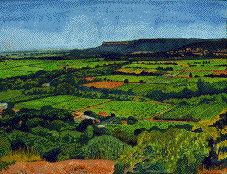
Much attention is given to recording and preserving European cultural heritage, but action on the rural heritage and its structures and techniques has fallen far behind.
There is an urgent need to understand that heritage and to carry out an inventory in the face of destruction attributable to recent agricultural techniques, rapid urban growth, and the threat of "de-farming" through shrinkage and set-aside. One of our objectives is to contribute to evaluating rural heritage and its impact on present-day landscapes.
Old forms of land use produced structures (field divisions, roads and paths. water control systems) which can still be observed today. The aim is to work out a typology which could be used at a European level. Knowledge of technical sources and coordination of the experiences of teams in this field should enable us to provide aids to research and interpretation via this Action.
The Action started in Spring 1995 and will last until its final report in September 2001. The chairperson is Prof. Monique CLAVEL-LÉVÊQUE, Institut des Sciences et Techniques de l'Antiquité, France. There are two vice-chairpersons, Prof. Okko BEHRENDS, Germany, and Frank VERMEULEN, Belgium (frank.vermeulen@rug.ac.be).
15 countries have signed the Memorandum of Understanding. The Secretary
is:
Mme. Anna DANTI
Commission des Communautés
Européennes
DG XII/AP2/COST
Sécretariat COST
Rue de
la Loi, 200
B- 1049 BRUXELLES
Tel: +32/2/296 54 82
Fax: +32/2/296
42 89
anna.danti@cec.eu.int
The French language has been agreed by Delegates as the main
working language used for this Action.
![]()
![]() To contribute to
a better understanding of the relationship between the natural environment and
human activities in ancient geosystems by establishing an inter-disciplinary
research programme to study their inter-related biotic and abiotic components,
together with man's strategies for intervention on the ground.
To contribute to
a better understanding of the relationship between the natural environment and
human activities in ancient geosystems by establishing an inter-disciplinary
research programme to study their inter-related biotic and abiotic components,
together with man's strategies for intervention on the ground.
![]() To derive appropriate
models based upon a variety of European regional data on ancient land systems,
using conceptions and interpretations based on a critique of current
methods.
To derive appropriate
models based upon a variety of European regional data on ancient land systems,
using conceptions and interpretations based on a critique of current
methods.
![]() To propose
tools to assist in diagnosis and decision-making on the investigation and
conservation of the "archives" on the ground, by cooperating in a European
framework with the aim of harmonizing practices and approaches to conserving
and enhancing the rural heritage.
To propose
tools to assist in diagnosis and decision-making on the investigation and
conservation of the "archives" on the ground, by cooperating in a European
framework with the aim of harmonizing practices and approaches to conserving
and enhancing the rural heritage.
![]() To produce research
tools for investigating landscapes and ancient cadastres.
To produce research
tools for investigating landscapes and ancient cadastres.
![]()
Coordinators: O. BEHRENDS (Germany)
Institut für
Römisches und Gemeines Recht,
Prinzenstrasse, 21,
D - 37073
GOTTINGEN
and L. CAPOGROSSI COLOGNESI (Italy).
The Group has finalised the first commented translation into French of the Roman "surveyor-geometers": "L'Etablissement des limites" by Hyginus Gromaticus (Napoli 1996) published by coedition OPOCE-JOVENE in the collection "Diaphora" (Editors: M. CLAVEL-LÉVÊQUE, A. GONZALES and F. REDUZZI) and "La Condition des terres" by Frontinus. These documents present spatial models, practices of measurements and management techniques for regular landscapes. The main data concern territories of colonisation, the parcelling and the modalities of distribution of parcels, the marking out of land boundaries, the road system and the spatial structuration. Comments give historical, legal, philological, astronomical, technical and religious details. The work of translation has been done in Besançon by the permanent Group with monthly meetings. It has been controlled by partners' contributions of which have been discussed and integrated. The whole operation has been reviewed in 3 main harmonization meetings (in Besançon in October 1995 and June 1996, and in Evora in November 1996).
Link to the home page of COST G2 Working Group 1
Coordinators: J. PETERSON (UK)
jwmp@sys.uea.ac.uk
and F. VERMEULEN
(Belgium)
frank.vermeulen@rug.ac.be.
Areas of current interest are:
Detection: image analysis (remote sensing, aerial photography, pattern recognition, detection of directionality and periodicity);
Analysis: morphology (modelling, for example by Geographical Information System (GIS) Simulation); metrology (e.g. statistical and Fourier analysis, to determine subdivisions of a centuriation, with significance estimates);
Integration: environment, settlement (Statistical tests of distribution of sites and other features; GIS techniques for investigating the effects of environmental variation on site distribution).
A Workshop was held in Ljubljana in Spring 1996 on "Methods and perspectives of GIS".
Link to the home page of COST G2 Working Group 2
Coordinators: M. CLAVEL-LÉVÊQUE (France), Institut des
Sciences et Techniques de l'Antiquité
and F. COARELLI (Italy)
Dipartimento di Studi Storico Artistici,
Sezione di Studi Comparati sulle
Societá Antiche,
Univ. de Perugia
iscsa@unipg.it
The Group has finalized the Atlas des formes d'occupation du sol en Europe which contains 14 dossiers on territories regularly registered and measured by "centuriation" in 5 countries (In Spain, the regions of Maresme, of Merida, of Saragossa and Ampurias; in France, the regions of Béziers and Arles; in Greece the region of Dymé; in ltaly, the regions of the valley of Umbria, Salento and Campania; in the UK, the region of Norfolk and in Tunisia the North East "Tell"). Three technical dossiers (pedology, interpretation of satellite images, and metrology) supplement the thematic dossiers They explain methods for reading and data restitution. All efforts have been made in order to maintain appropriate consistency and the specificity of each geographical area. (Editors : M. CLAVEL-LÉVÊQUE and A. VIGNOT).
Link to the home page of COST G2 Working Group 3
Coordinators: F. J. SANCHEZ PALENCIA (Spain)
Centro de Estudios
Historicos del C.S.I.C.,
Departamento de Historia Antigua y
Arqueología,
Duque de Medinaceli, 6,
E - 28014 MADRID)
jspalencia@ceh.csic.es
and H.J.M.
MASCARENHAS (Portugal)
jmm@evunix.uevora.pt
The main objectives are the study and mapping of proposed or potential
areas as cultural parks:
the proposals must be remarkable and
representative of their diversity e g. areas with linear land planning, "rural
fossilized" soils, modified rural soils, degraded soils, etc.;
the
definition of the concept of cultural park as an element of planning in the
policies of natural and historical patrimony, including the study of legal
arrangements proposed by expert committees at national, European and
international level, the setting up of recommendations for general criteria,
and of efficient tools for management' and planning regarding cultural
parks.
A workshop was held at Evora on "Cultural Parks".
Link to the home page of COST G2 Working Group 4
There is an increasing demand, particularly among territorial and
administrative bodies, to have the heritage protected and enhanced,
particularly when under threat.
The results of the action should provide
tools to assist in decision making in cultural and technical areas and also in
the economic field.
From the interest to date shown in this COST action the estimated effort
in the joint European network involves a total estimated cost of approximately
4 500 000 ecu/year. This budget is covered from national sources in
participating countries. The COSTG2 program supports the following
activities:
![]() organisation of
workshops and publication of proceedings;
organisation of
workshops and publication of proceedings;
![]() initiation of joint research
efforts;
initiation of joint research
efforts;
![]() publication of ancient
technical sources;
publication of ancient
technical sources;
![]() publication
of Atlas of ancient cadastres and land use.
publication
of Atlas of ancient cadastres and land use.
Send all comments, updates and queries to these WWW pages to jwmp@cmp.uea.ac.uk
13 27 November 2003 updated by John Peterson and John Wilcock
j.d.wilcock@staffs.ac.uk